Greenwich High Road (Stockwell Street to Royal Hill intersections)
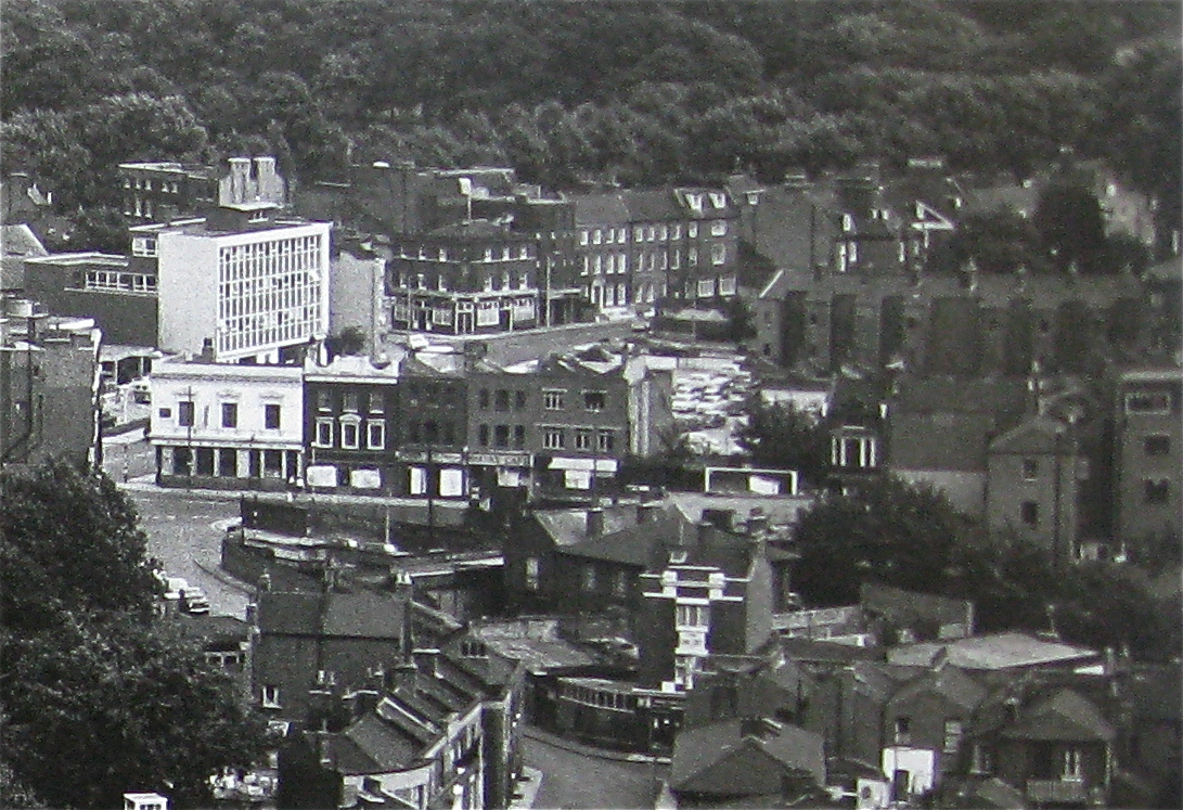
The 1st shot shows the bottom end of Greenwich High Road towards Stockwell street. You can see John Humphrey house on Stockwell Street - so this photo must have been taken post 1960s? What is interesting is that all the buildings on the Stockwell Street side of Greenwich High Rd have gone now (replaced by Cafe Rouge, the Ibis Hotel and the Cinema). The one building that looks most intriguing is the one with pillars on the frontage (middle right of the 1st photo - click it to see a bigger version). What is this? You can also see the backs of the buildings on Burney Street near the top end junction with Stockwell Street. Again these have gone.
The 2nd shot
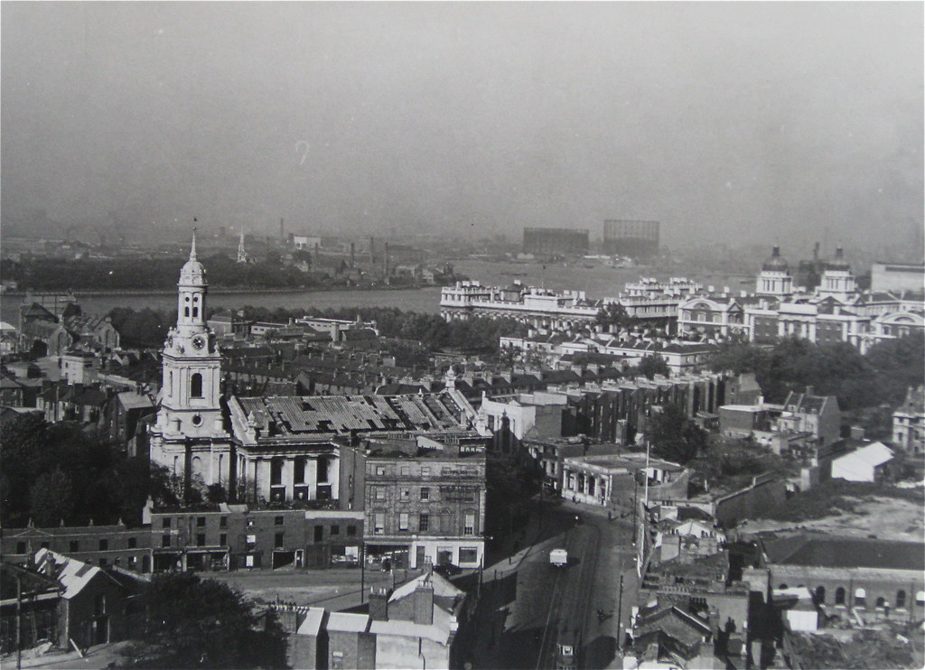
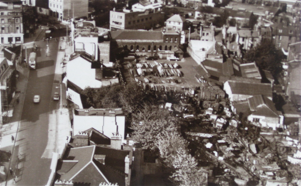
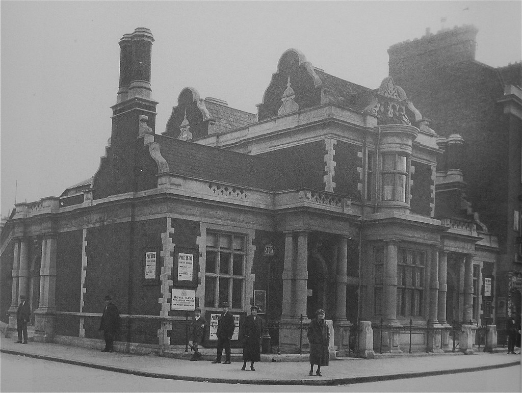
1 was taken c1949. St Alfege's Church is burnt out. There are lots of empty spaces where shops use to be. The big gap on the bottom left of the picture looks like the space where Somerfield's car park is now. The 3rd shot looks like it was taken at a similar time. You can see the Parkway station building on the bottom right. You can also see the line of buildings that use to be behind the current day Mitre pub. The 4th shot is later still as the tram lines are gone and the building at the top of Greenwich High Road has been re-built (now NatWest bank). You can still see the Parkway station building - the line has been filled in and is being used as a timber yard in this picture.
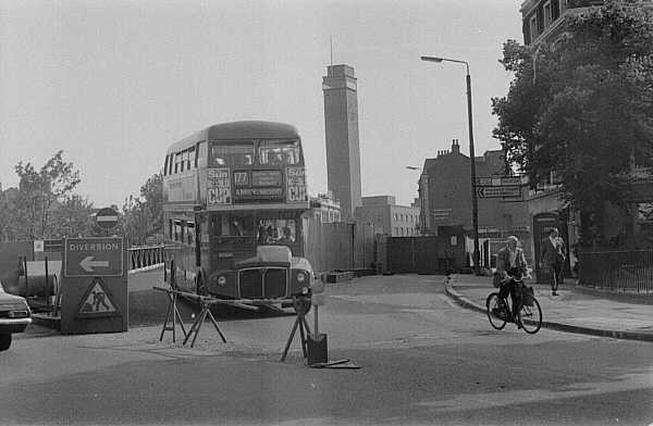
The next group of three shots show the bottom end of Greenwich High Rd. The 1st is from 1968, the 3rd from June 1970 and both sourced from the website
yellins.com. You can get a good feel for what was there before the Ibis complex of buildings from the 1st shot. It must have been taken at a similar time to the left hand shot above as the buildings on the left look in the same poor state in both photos. You can also see a little bit more of that building with what I thought had pillars on the frontage - these aren't pillars but just the uprights of two large Victorian bay windows. You can also see an interesting building just to the left of Meridian House. More on this later. In the 2nd shot
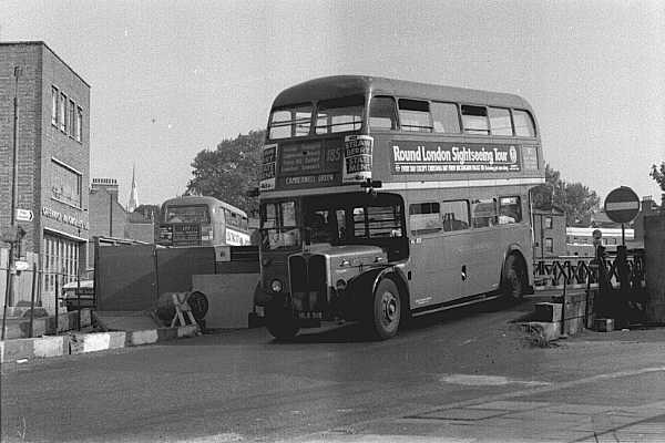
3, taken in 1970, you can see the Mitre pub building on the right. The 2nd & 3rd shots show a temporary bridge over the railway line.
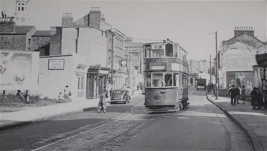
This next shot was taken in 1951 comes from a great
website on London Trams by Dewi Williams. Dewi describes this picture as
"Tram 1995 on route 40 to Savoy St. Strand, coming out of single-track section." Dewi also sets out that the "Power plant in Greenwich was originally used to generate power for the tramways, after 1952 it was used to provide peak hour support to the main LUL power station at Lots Road, Chelsea. Since October 2002 and the closure of Lots Road, Greenwich is now on standby to provide emergency power supplies to the Underground in the event of a National Network failure. The chimneys have been reduced in height due to conversion from coal to oil and gas operation. The dome (on the skyline at the left) is one of two which belong to Greenwich Naval College (now Greenwich University)".
This 1st shot is interesting because it bares no resemblance to any of the buildings there today (see 2nd shot). The intersection on the right of the photo is Royal Hill. The top part of the building (above the tram) looks grand. This housed the Workshops for the Blind - which were established in 1877. The building was demolished but parts of the stonework were incorporated in to the redevelopment of the site (I'm assuming this is Serica Court). You can just see the top of this building in 2nd and 4th pictures at the top of this page (you can see the ornate triangle structure on the top part of the building in the bottom of these shots). You can also see it in more detail in the 5th picture above and just make it out in the 3rd and 4th shots below (in the group of 5 photos). The 4th shot
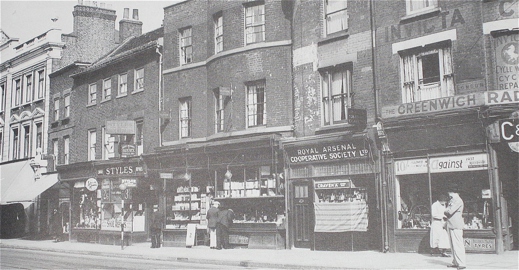
14 was taken in 1937 and shows exactly what was there before Serica Court. Starting from the left, you have the Workshop for the Blind, then Styles shoe repairers, Glaishers bookshop, the Royal Arsenal Cooperative Society Ltd's tabacco shop and C&C Motors on the corner of Greenwich High Road and Royal Hill. If you look at the
LCC bomb map you can see that these buildings (bar the Workshop for the Blind building) suffered heavy bomb damage in the war.
If you look at the larger versions of the 1st & 2nd pictures above you can make out one of domes on the present day maritime museum. The 3rd shot
8 above is slightly further down. The building to the left of the chimney in the 1st shot, is on the right of the 3rd shot. The 3rd shot must have been taken around about the same time as the 1st shot as the same poster advert exists in both shots. (See the wall of poster advertisements below the building on the right of the 3rd shot. The 3rd poster from the left is the same in both shots).
Greenwich High Road (Royal Hill to Greenwich South Street intersections)
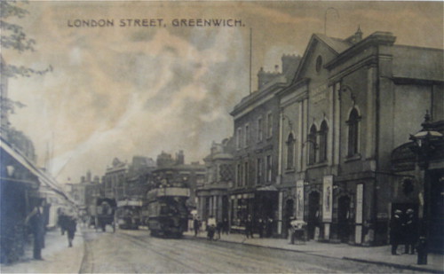
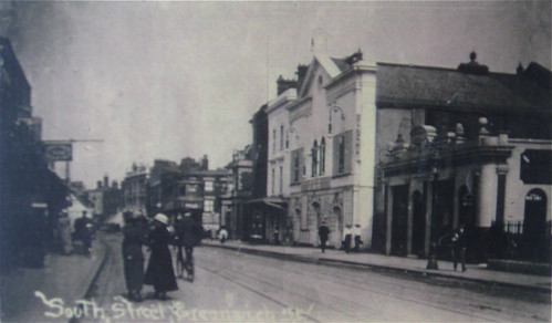
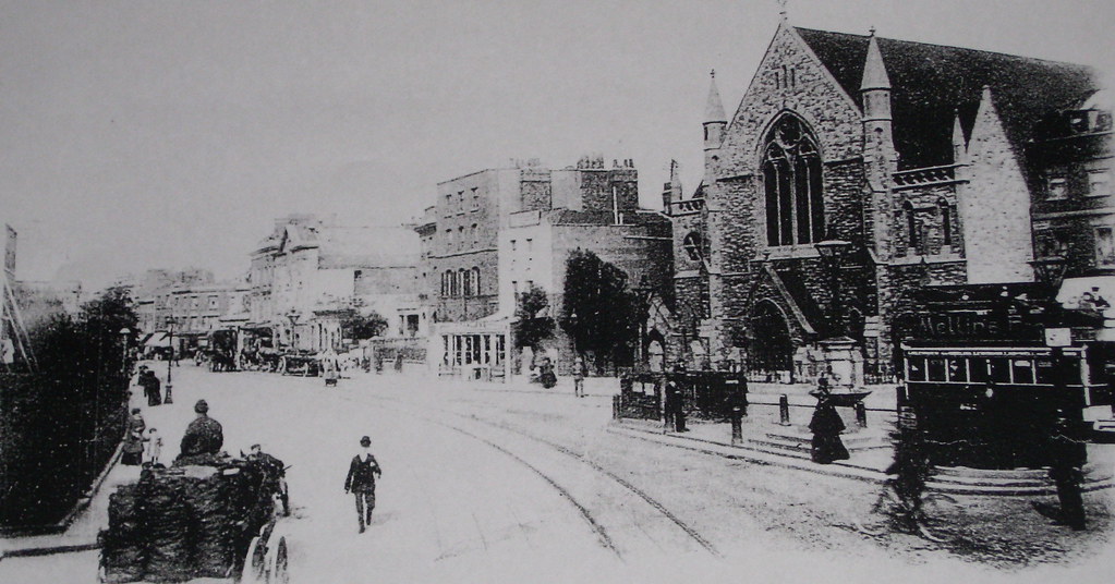
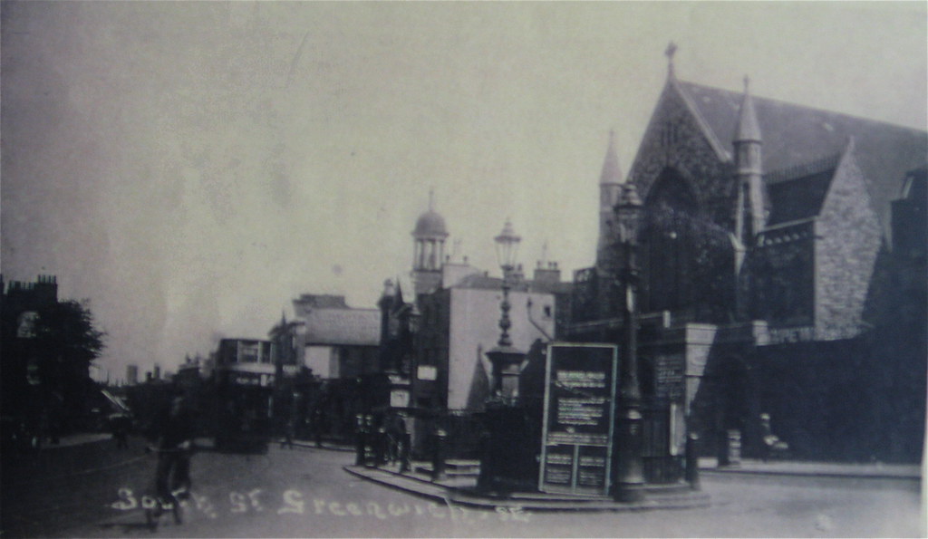
In the 1st picture the building on the right is called The Carlton Theatre, you can see this building in all the 5 shots below. In the 2nd picture - on the right side of the tram you can see the Greenwich Bath House. This was on the intersection of Greenwich High Road with Royal Hill (it's now Meridian House). The 2nd picture is the same view as the 1st shot but you can see a bit more of the building on the right. I reckon this use to be the ornate entrance/frontage to a public house - which was adjacent to the now library. (You can see P.H. marked on the 1894 & 1914 map next to the Library). The 3rd shot8 must be from the very early part of the 20th Century as the theatre was only called the Carlton Theatre from 1900-1910 (see the roof of the building). It must also be before 1907 when the library was built, as you can see the building that existed before the Library (building on the far right of the shot). It also cannot be before 1900 as the tram in the picture would have been horse drawn. In the 4th and 5th shots you can see the church on the intersection of High Road (or London Street as it was known then) with South Street. The 4th was taken before 1907 (i.e pre-Library). The 5th is post library, pre 2nd world war as you can just see the small dome and columns (see centre of picture) of West Greenwich Library. If you look down from the small dome you can see the flat side of a building. This is the building next to the current Library, although it now has windows in the side (see modern shot in the group of three pictures below).
The Carlton Theatre building had many names including Carlton Theatre from 1902-08, Morton's Theatre from 1889-96, 1900-01, Morton's Model Theatre (after the name of the lessee W Morton) from 1897-99, Prince of Wales' Theatre and Theatre Royal, Greenwich. It then became a Cinema De Luxe. The
theatre was demolished in 1937 to make way for the new Town Hall. This is a good link to a poster from 1888 showing an event when it was called the Prince of Wales Theatre. Also here is a link to Tony Proctor's blog on the theatre. See his comments below.
This first shot below was taken sometime between 1937 - 1945 as Meridian House was built in 1937 and you can still see the church which was lost in the second world War. Looking at the modern 2nd shot you can see that the spire on the dome has gone. [I wonder what happened to it?]. The 3rd shot shows the Greenwich bath house in all its former glory.
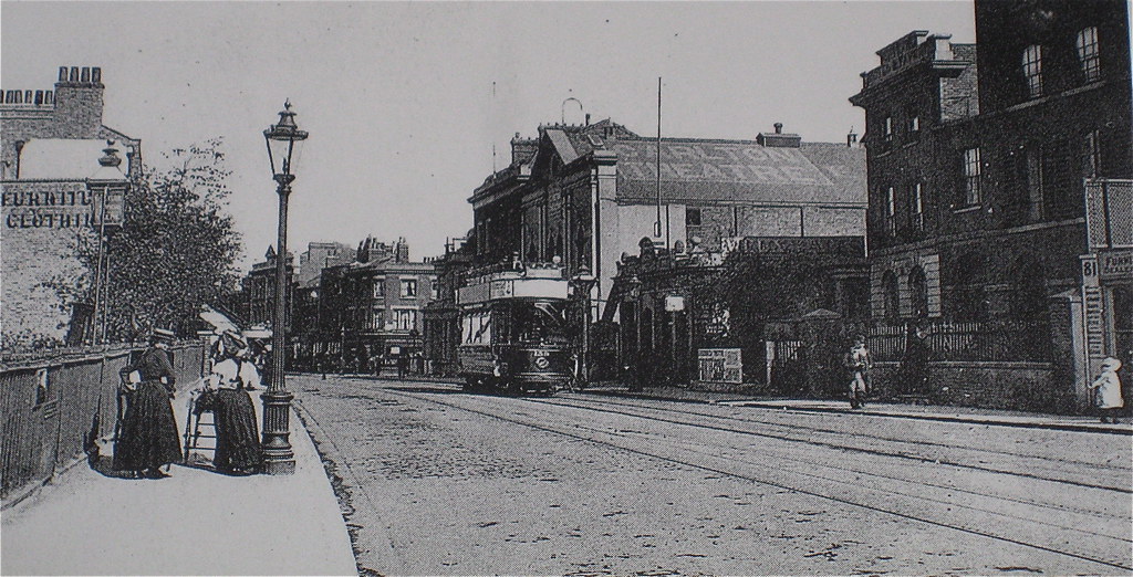
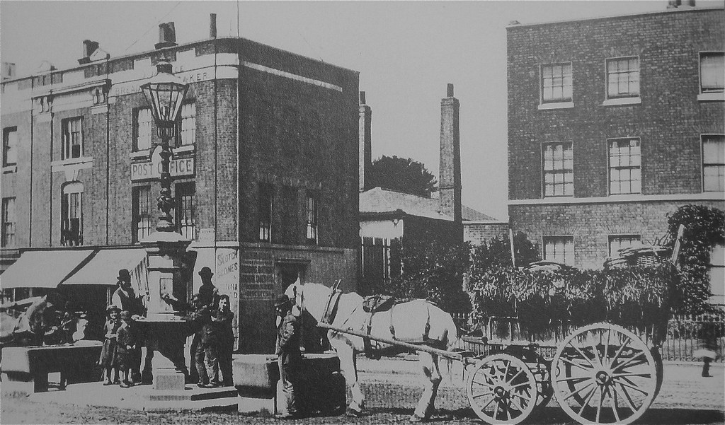
The next shot is the earliest photo of Greenwich High Road taken in 1884. The lamp on the drinking fountain was left to the people of Greenwich by
Sir David Salomons, a former MP
1
The 2nd shot come from a great website called
londontramways.net. It shows one of the many london tram photos taken by AJ Willis over the period 1949-1952. See the building to the right of the library - the single story front extension is in place but the side windows have yet to be put in (as with the 2nd of 6 shots above).
Greenwich High Road (Greenwich South Street to Blackheath Road intersections)
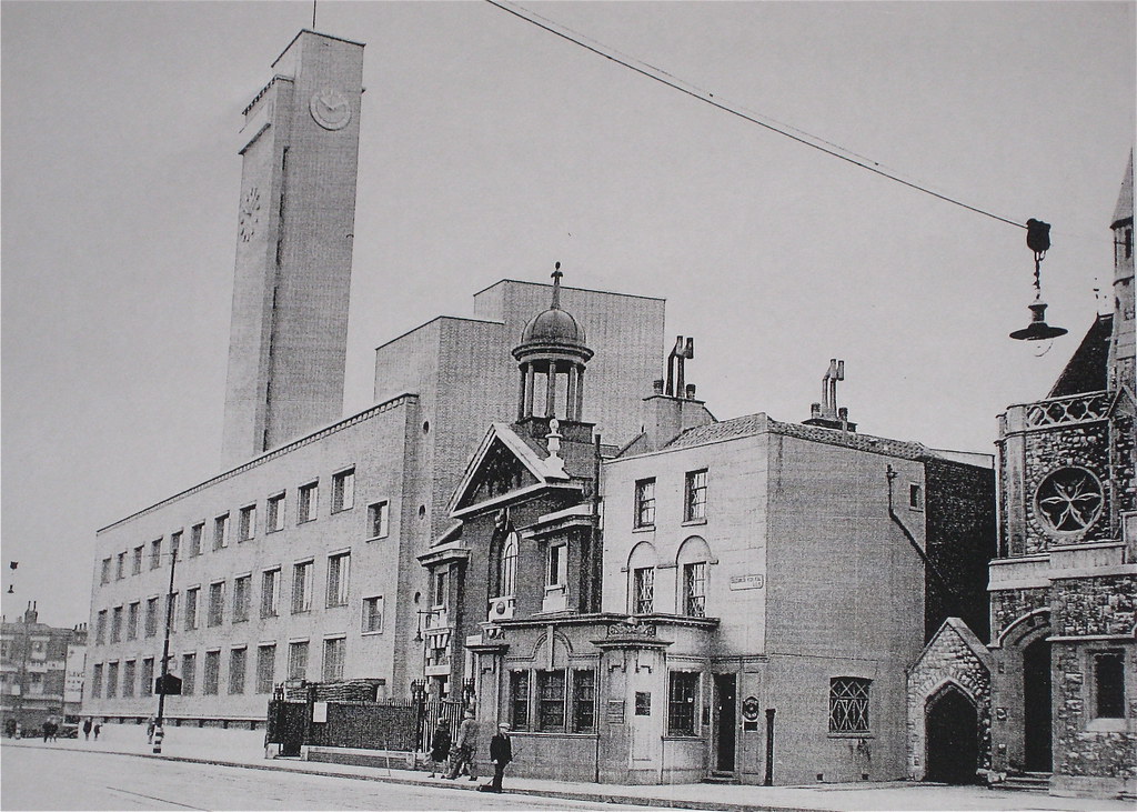
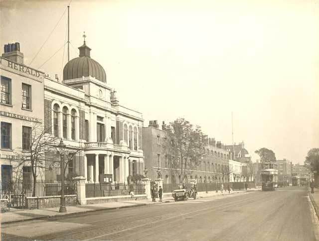
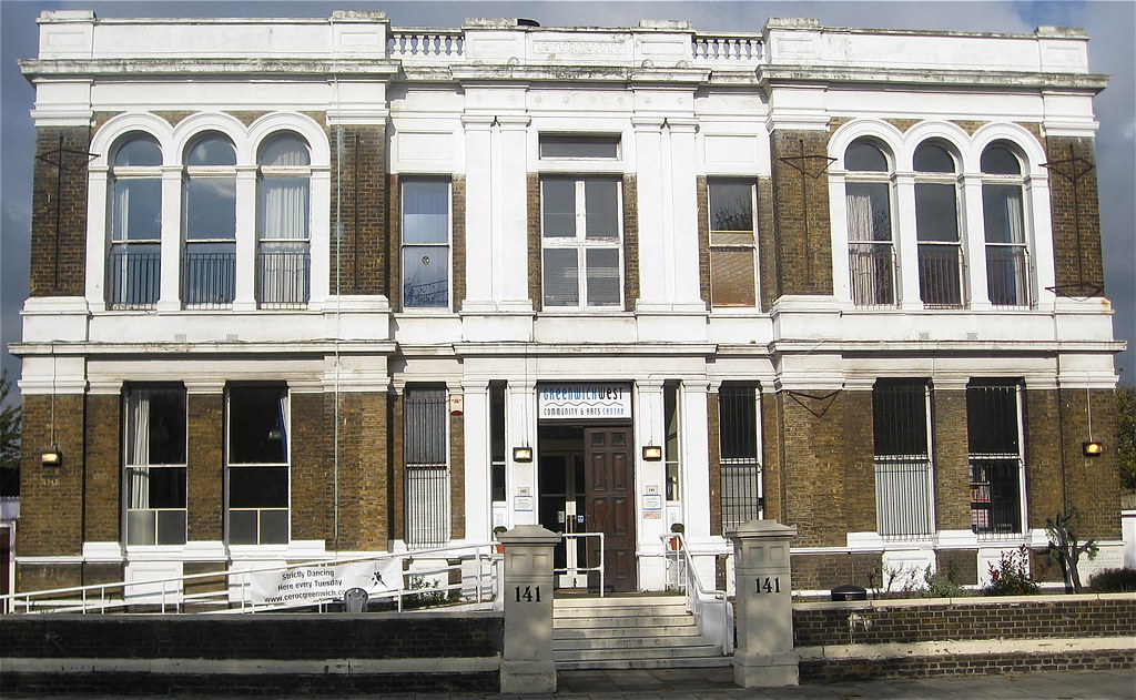
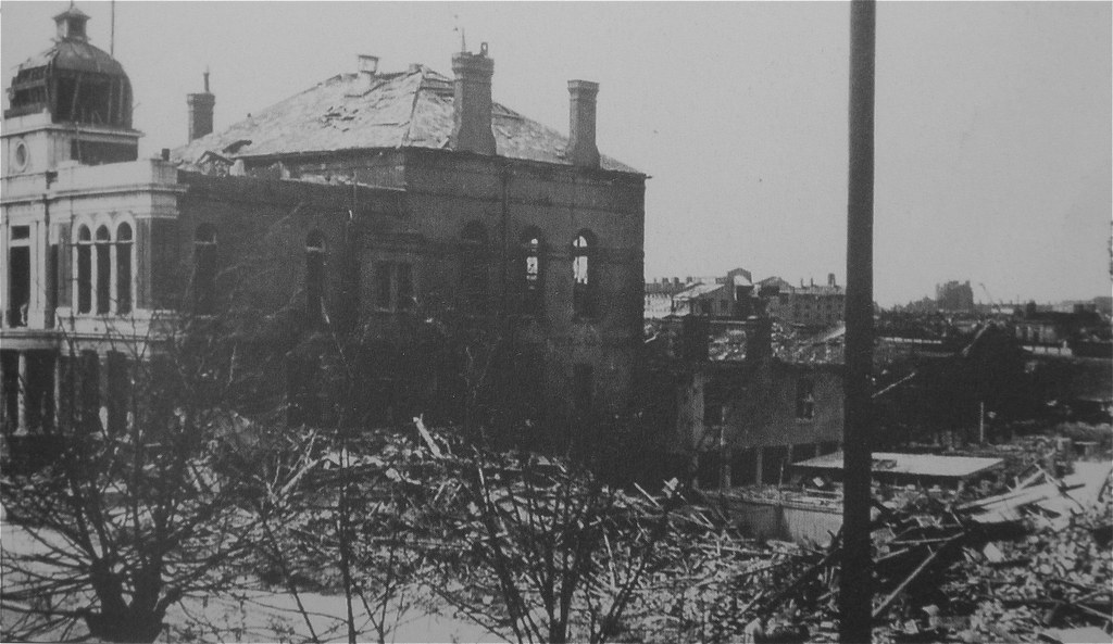
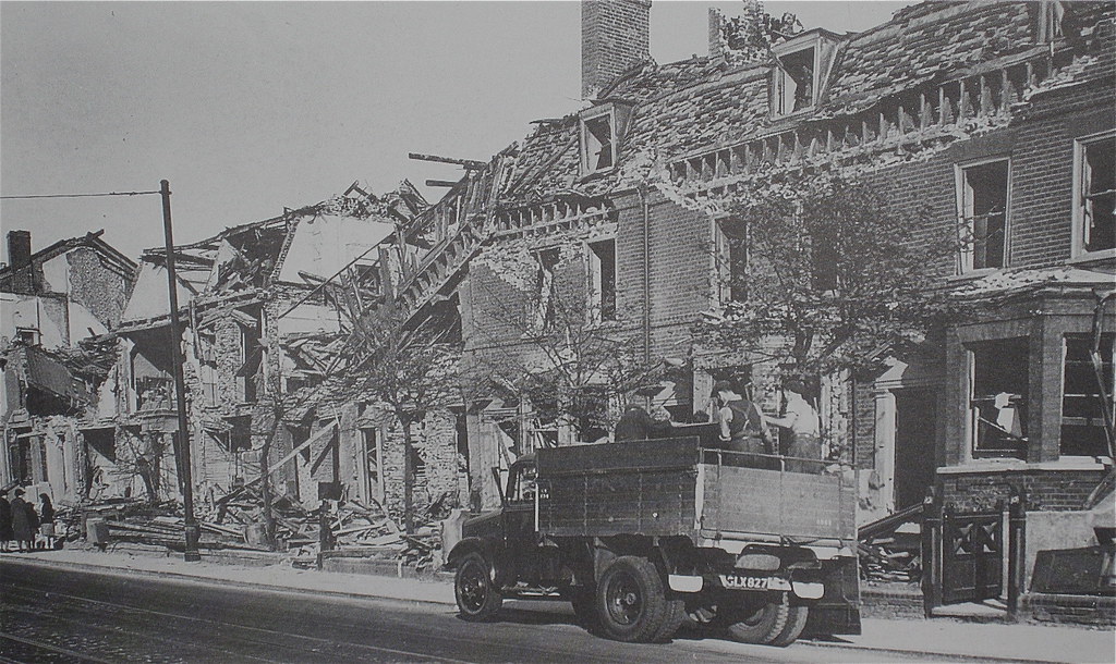
In this group of three shots the 1st one is from c1925. In the centre of the shot is the then Greenwich Town Hall. Town hall between 1900 and 1939 (until it moved further up the street to Meridian House). Today this building is West Greenwich house. The terrace of houses between the Town Hall and the tram were hit by a V1 bomb on 12 July 1944. The dome and part of the roof were also damaged by the bomb (you can just see this damage in the 3rd picture). It's assumed that the dome was subsequently dismantled, along with the columns and balcony to the front. The building to the left of the Town Hall in the 1st shot has now gone. You can just make out "Herald" on the upper part of the building. The 2nd shot is a modern day picture (no columns, no balcony, no dome). Still impressive but less so without the twiddly bits! The 4th shot shows the south side of Greenwich High road opposite the terrace next to West Greenwich House. It was taken on 12 July 1944. Eight houses were destroyed when the V1 landed on the terrace opposite. Three of the terrace of houses in the picture remain today.
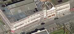
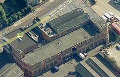
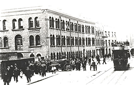
Further up to the road towards the Blackheath Road end was Skillions. Build c1929 by architects Campbell, Jones, Sons & Smith. Sadly demolished in 2008. The 5th picture
4 is the original Merryweathers building on the site. The final shot was taken in 1945.
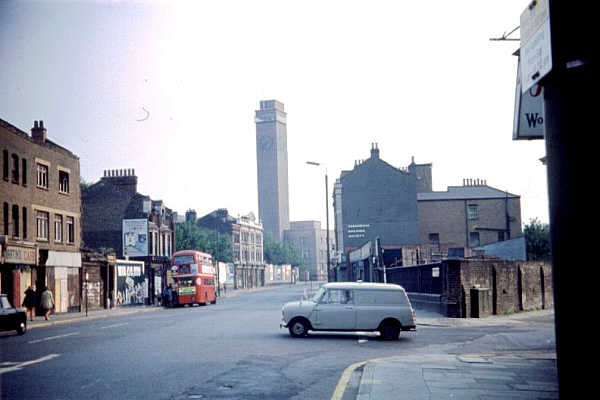
The final two shots show the Blackheath Road end of High Road. The 1st is a 1960s shot from Adrian Spaldings collection. You can just see Skillions in the picture. The 2nd
11 is from around 1949-1952. You can also see Skillions in the picture.
Building changes on Greenwich High Road
Greenwich High Road has certainly seen significant change over the past century. Key changes include:
- Skillions (replaced by the Premier Inn and residential accommodation. Skillions was demolished in 2008);
- Greenwich Bath House (now Meridian House. The bath house was replaced by the Arches in East Greenwich. The Arches being the next generation bath house building of the time.)
- Carlton Theatre (now Meridian House);
- the Terrace next to the old Greenwich Town Hall (now West Greenwich house) - unfortunately a sad war loss;
- the Methodist Church on the intersection of High Rd & South St - again another sad war loss;
- Maitland House / Jubiliee Alms Houses - more on both when I can unearth some pictures;
- the dome on top of West Greenwich House (sadly not rebuilt after bomb damage); and
- the building that housed the Workshop for the Blind (it survived till 1987 when it was redeveloped into Serica Court). Some of the stone work from this building can still be seen near the Clock Tower market. There are also a couple of benches made out of the stonework on Burney Street.
 Uploading ....